
One of the topics that catch people's attention during a lecture about lighting with Blender is volumetric light. In a broader context and not only about architecture. But, can we use it for architectural visualization? For commercial advertisement, I can't see much use on volumetric lights for scenes like interior views.
But, if your objective is to produce a birdseye animation of your building and by that you want to use some environmental effects, a volume light could become useful.
Just imagine a project in a city or region with weather conditions that often resume to fog and some light rain. A scenario where the use of such environmental effects could replicate the visual context of the site.
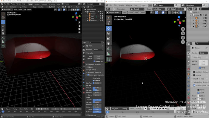
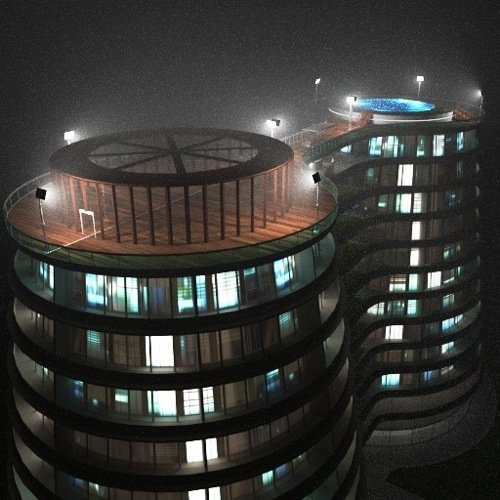
Do you want to download a full scene with volumetric lights ready for architecture? An artist named MarcoD did an excellent job with an architectural view, using volumetric lights for architecture and posted that on Blend Swap. You can download the file from this link.
Not only you get the scene with all settings for volumetric lights, but also a full model of a building. It is an excellent example of what you can do with an aerial view of a building using volumetric lights for architecture.
Other highlights of the scene include the model itself, and a permissive licensing. You will find small assets and objects that you could use on other projects. The building itself could compose the background of a scene. About the licensing, you will notice it is creative commons zero. So, you can do whatever you like with the file and assets.
You now have an extra resource to learn about volumetric lights for architecture.